LCS3 GPS Reference Station
Rinex Data Files: Linn County provides thirty days of hourly observation and navigation data, available in Rinex and Trimble format.
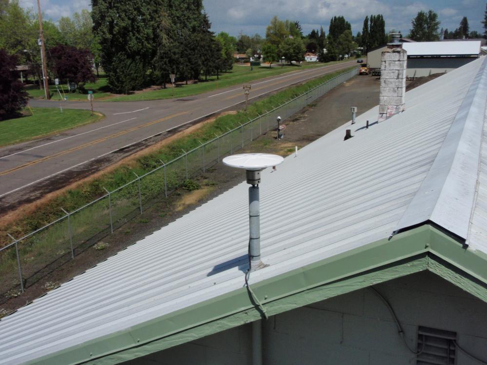
Location: The antenna is located at the Linn County Road Department Shops, 1487 W. 1st Street, Halsey, Oregon.
Equipment: Linn County uses a Trimble NetR9 GPS receiver coupled with a Zephyr Geodetic 3 GNSS antenna.
Status: The Oregon Department of Transportation Geometronics Unit computed the latitude, longitude, and ellipsoid height at the Antenna Reference Point (ARP) by processing and adjusting five days of data using the National Geodetic Survey’s Opus Projects software. The position is referenced to NAD83(2011)epoch 2010.00.
Description: The station is a 2 inch galvanized iron pipe, 4 feet long; permanently attached to the South end of the building.
Elevation: The Orthometric height at the Antenna Reference Point is referenced to NAVD88 and was computed by applying the Geoid 12A geoid separation to the ellipsoid height.
Geographic Coordinates
Latitude (NAD 83/2011 Epoch 2010) 44°22'39.21880"
Longitude (NAD 83/2011 Epoch 2010) 123°06'32.76660"
Ellipsoidal Height (NAVD 88) 72.279(m) 237.13(us survey ft.)
Oregon North Zone (SPC)
Northing (NAD 83/2011 Epoch 2010) 82354.416(m) 270191.6535(ift.)
Easting (NAD 83/2011 Epoch 2010) 2292103.887(m) 7520025.8760(ift.)
Orthometric Height (NAVD 88) 95.383(m) 312.9326(us survey ft.)(NAVD 88) 95.383(m) 312.9326(us survey ft.)
Disclaimer: LINN COUNTY shall in no event be liable for any lost profits, and special, indirect or consequential damages to any party, arising out of or in connection with the use or the inability to use the date heron or the services provided. Linn County provides this data and it's services as a convenience to it's customers. Furthermore, Linn County reserves the right to change, revise, or otherwise discontinue published data and/or these services at any time without further notice.